The photo gallery for New Mexico - South is found at this link.
Birds/Birding
The New Mexico Birds page on this site has a complete index to the photographs and video of bird species I have recorded in New Mexico. New Mexico Bird Photos is my gallery of photos from throughout the state. I also maintain a video portfolio on bird species in this area: The Birds of the United States and Canada.
I also maintain The Black Range website which is dedicated to this mountain range in southwestern New Mexico. On that website I maintain a photo gallery of birds I have photographed in the Black Range. There are also site guides useful in birding southwestern New Mexico.
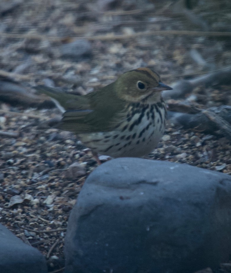
Birding in southern New Mexico is quite good, our yard list (as of November 2020) is 168 species. That list includes a few “one-offs”, vagrants that we really don’t think we will see again. For instance, an Ovenbird, my first Ovenbird occurred shortly after I saw my first Anhinga - in Florida. Thirty years after my first Anhinga - an Ovenbird showed up in our yard in New Mexico -- the first January sighting in New Mexico, west of the Rio Grande according to the Rare Bird Committee. Here are my notes from January 15, 2010:
"Yesterday morning I fell prey to the great birdwatching sin - assumptive birding. As we prepared to leave home for some exploring north of Monticello I noticed a small bird under a bush near one of the feeders. It was turned sideways and was obscured by leaves and branches but I could see a strong white eye-ring and strong spotting on a white underside and chest - otherwise the bird appeared to be a light brown. It moved its head and I thought I picked up a bit of orange on the crown and immediately thought Ovenbird - but then it flushed into the bush and I began to second guess myself - had I really seen the orange - could it have been a strongly marked Hermit Thrush? And, an Ovenbird would be out of range. Well, after much musing and a no-show of a bird I concluded that it was a Hermit Thrush and continued to pack our gear. Then - of course - the thrush returned as an Ovenbird and I enjoyed some nice views, but no good photos - the one above is typical of the lot."
New Mexico brings a whole new set of identification problems to work out. Take the differences between the Common Raven and the Chihuahuan Raven, for example. The Chihuahuan Raven’s call can be (at times) different from the Common Raven. Of more assistance, perhaps, is that the bill of the Chihuahuan is said to be thicker and the bristles on the bill are said to be longer. I have separated the two based on the color of the base of the neck feathers but here in Hillsboro I have discovered that the neck feathers are not much use in identifying a bird in flight.
In December 2007, I started my introduction to birding New Mexico. I birded along the Rio Grande (which is about 30 minutes from Hillsboro) in the morning. Once I made it through the tangle I had good birding: Greater Roadrunner, Bewick’s Wren, House Finch, White-crowned Sparrow, Dark-eyed Junco, Black Phoebe (doing a dance on the water as it picked insects from the surface), Northern Harrier, Gambel’s Quail, Greater Yellowlegs, Killdeer, Loggerhead Shrike, American Kestrel, Mourning Dove, Great Blue Heron, Red-tailed Hawk, Common Merganser, and Mallard. It was cold - enabling me to watch Finches walk across the ice along some Rio Grande sand bars. In the afternoon, I ventured into the foothills where I added Scaled Quail to the list.
Bosque del Apache National Wildlife Refuge
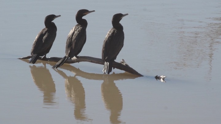
One of the premier birding sites in the western United States, Bosque del Apache NWR, is about two hours north of where I live in Hillsboro. Although not as often as you might think, I frequently stop at the Refuge to travel the road. It is especially known for the concentrations of Sandhill Cranes and Snow Geese which are found there during the winter.
During mid-week in the shoulder and summer months the place is not overrun with birders and tourists. The birds of the season include; Northern Pintail, Canvasback, Mallards, American Coot, etc. congregated whereever there is water. Neotropic Cormorants (photo above) can often be found in the pools - the reflections are always nice.
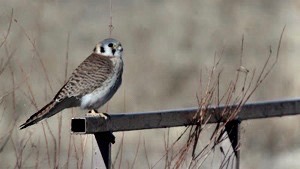
American Kestrels (photo right) are often cooperative, for a Kestrel. Typically there will be Northern Harriers, Red-tailed Hawks, and Bald Eagles about.
If you come for the Sandhill Cranes, especially in the winter, it is easy to spend half of the day perched about the farm fields taking video of Sandhills flying, Sandhills on the ground, Sandhills making a racket, Sandhills getting ready for the mating dances -- in short, Sandhills. There are good numbers, close in, and full of antics. I always enjoy the experience immensely.
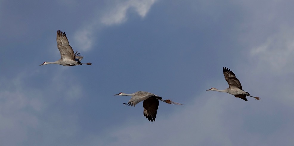
Sandhill Crane, Grus canadensis - Bosque del Apache National Wildlife Refuge New Mexico
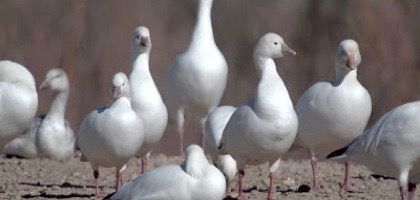
The flocks of Ross’s and Snow Geese often remind me of the incredibly large flocks I use to see near Burns, Oregon. It is always a good opportunity to compare Ross's (photo right) and Snow Geese. As you might expect for this location the number of blue morph Snow Geese is vastly exceeded by the number of white birds.
It is a great place to watch behavior; flocking and dancing cranes, raptors on the hunt, and sparrows in the hedges.
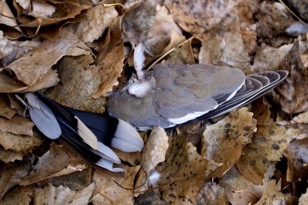
Sometimes death occurs publicly and with much activity, sometimes in comes in the quiet of night. I am not sure when a White-winged Dove (below) died outside our back door. All that remains of its death are a few feathers nestled in a bed of leaves. I mention this only because the tranquility of those feathers serves as the bookend of an event which I once watched at Bosque del Apache National Wildlife Refuge.
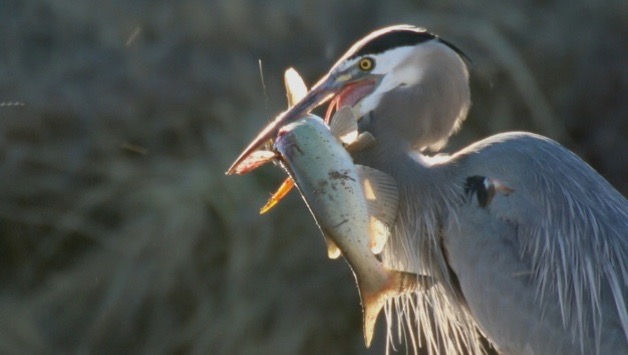 And I mention it here only because it is conceivable that the event at the Bosque could have occurred here in the Black Range (if you ignore the size of the fish). I have watched Great Blue Herons, like the one pictured to the right, hunt and feed many times. Sometimes, I have seen them catch rather large rodents and swallow them whole - but usually I have watched as they caught and ate small critters.
On this occasion, I watched as a Great Blue Heron caught a large catfish. Unlike smaller fishes, this one did not disappear down the heron’s throat in a nanosecond. There were a number of problems facing the heron. First of all the fish was alive. I watched as the heron repeatedly stabbed the fish with its beak. The heron would place the fish on the ground walk back a foot or two and then, with significant force, strike the catfish in the area behind the skull. The force of the impact was surprising to me. The heron would then face the problem of getting the impaled fish off of its beak. It would stand, letting gravity do some work, trying to move its beak in an effort to speed the process. This went only for fifteen minutes or so and then the fish ceased to move. The heron then faced a second problem. How to swallow such a meal. This second problem was two-faceted. First of all, the fish was heavy and difficult to get above the heron’s head (so that it could be swallowed). Secondly, the head of the catfish was too large for the entrance of the heron’s throat. More blows to the head followed as the heron attempted to break the ridge skull of the fish. After significant work, the heron would manage to align the head of the fish within its mouth, but the weight was such that it would eventually slip from its “grasp”. Eventually, the head was broken enough to be swallowed, the fish was aligned head first in the mouth of the heron, and with one swift move the heron raised its bill skyward and swallowed the catfish.
Along the Rio Grande
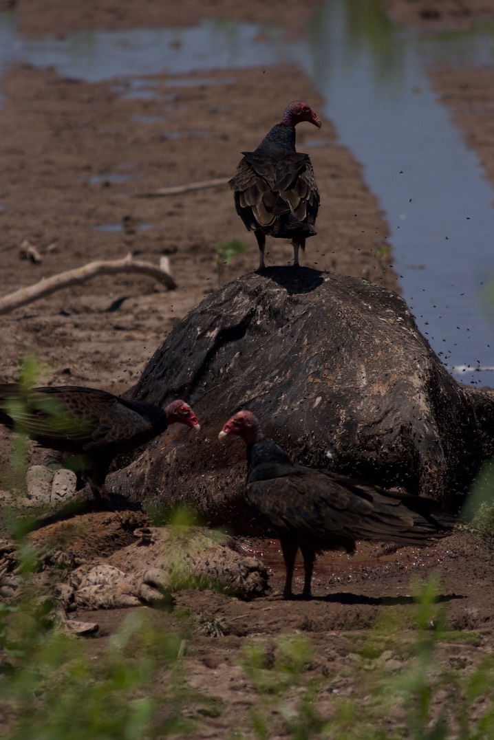
There are often animal carcasses along roads and tracks. I once took my portable blind, set it up several yards from a carcass and waited. Over the course of four hours I became well acquainted with several flies and hundreds of their friends, a pervasive smell of rotting flesh, and a constantly rising temperature - in the mid-nineties when I left. There were Blue Grosbeaks, Barn Swallows, and Nighthawks about -- and Turkey Vultures. I decided not to show a Turkey Vulture head deep in cow, rather some waiting their turn. The Variegated Meadowhawk perched a few feet in front of the blind and the Chihuahuan Greater Earless Lizard was in the road on my way out. An enjoyable time.
Percha Dam is an impoundment structure on the Rio Grande River between Truth or Consequences and Hatch, New Mexico. There are a series of dams in the area. The Rio Grande River is a natural migratory route. The range of many bird species reflect the river basin created by the Rio Grande, not only does it provide a source of water in a dry climate but it is much lower in elevation than some of the surrounding mountains.
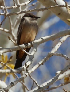
This can be a very good location for photograph and video. For instance, on February 6, 2015, I was at Percha Dam State Park doing a bit of video, I was not there for very long but did manage some video of Say’s Phoebe, Phainopepla, Lincoln’s Sparrow, Western Bluebird, Black Phoebe, and Spotted Sandpiper.
Other Natural History
I maintain a substantial amount of natural history material on this site, in addition to the birding sections described above. They are:
- New Mexico - Reptiles and Amphibians
- New Mexico - Butterflies and Moths
- New Mexico Flora
- New Mexico Mammals
- New Mexico - Bugs
- The Black Range Website has an extensive section on the natural history of those mountains.
At the Rio Grande crossing just north of Truth or Consequences we sometimes turn south on a nicely graded road. By the time we reach the head of the Caballo Reservoir the road has long since turned to a track and that eventually petered out. As we go a bit sideways in deep sand and loose rock I sometimes worry that Rebecca will have to dig us out - it can be hot out there and I can become concerned that she might become irritated. In any case, it is a beautiful drive, right along the river at times (a substantial release from Elephant Butte might mean that there were standing waves in places - not huge, I admit, but standing none-the-less) and through cattle pastures which actually had green grass.
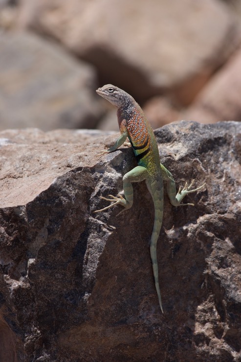
Along the way, I have taken photos of the Chihuahuan Greater Earless Lizard, Cophosaurus texanus scitulus (very difficult to identify since it is on the cover of "Lizards of the American Southwest") (photo above).
Prehistoric Pathways National Monument
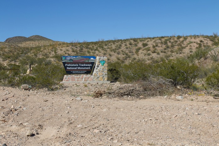
The winter are a great time to visit Prehistoric Trackways National Monument, northeast of Las Cruces, since there is no shade along the trails. We have visited this site on several occasions It is a new Monument and the BLM staff doesn't seem to be very forthcoming with information.
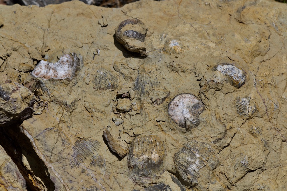
The Ridge Line Trail starts at the only signage in the Monument (photo right) and heads out across the flats. After a while the trail begins to climb up the hills, affording nice views to the west - and if you like sprawl, of Las Cruces to the southeast. The hillsides are covered in loose rock but the trail itself is very reasonable. We found fishhook cactus of various age as well as several other species or cactus. The marine fossils (photo below) seemed to be grouped in an area at the crest of the first hill.
White Sands National Park
My experience with selenite crystals had been limited to those of Salt Plains National Wildlife Refuge, Oklahoma, prior to my visit to Lake Lucero. The gypsum “sand” dunes of White Sands National Monument have their origin in the gypsum of Lake Lucero. The selenite crystals at Lake Lucero (pictured here) may not be collected and they are quite different from those at Salt Plains. Both are impressive. For those who may have considered a trip to Lake Lucero I recommend it heartedly (contact the White Sands National Park headquarters for information - access is possible but controlled).
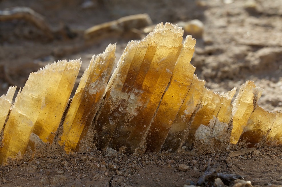
Lake Lucero, White Sands National Park, NM - seletnite crystals
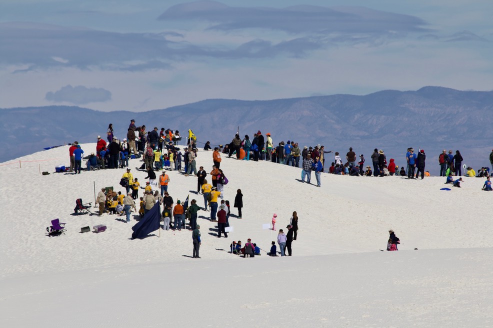
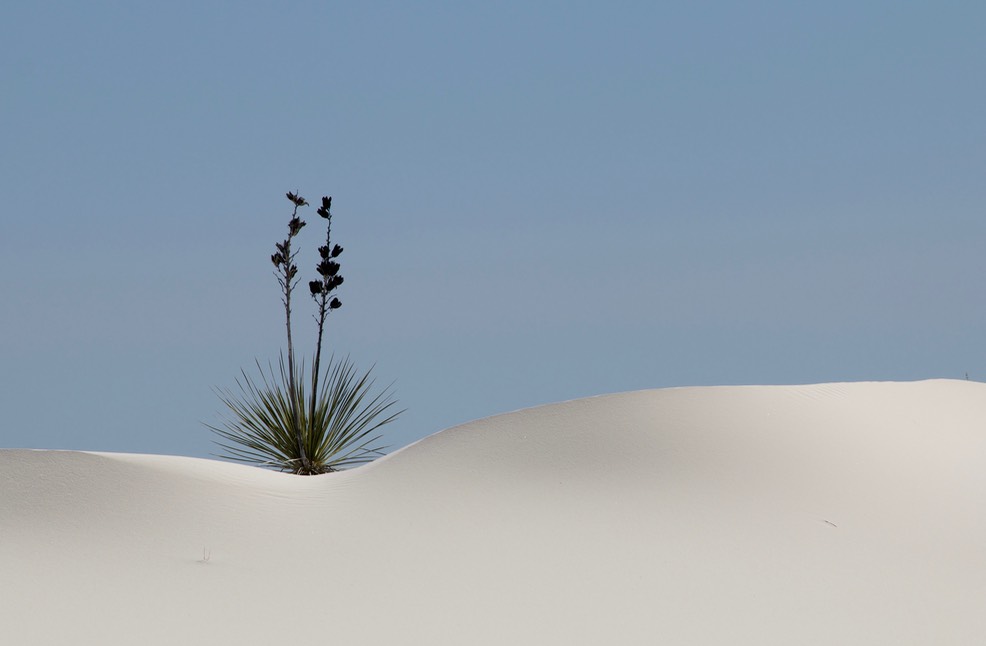
At the end of February 28, 2015 we ventured over to White Sands National Park to show my brother one of the few gypsum dunefields in the world and by far the largest with a surface area of 275 square miles. As you enter the dunes from the south there is a fair amount of vegetation growing on them. In places you can see the very tops of cottonwood trees poking through the dunes. As you drive north the dunes become more and more desolate. Driving through them makes me think of driving in the far north, in winter, the road is white and hills of white are all you can see. This is a favorite playground for this region, people come to photograph the dunes, to hike across the dunes, and to ride all sorts of plastic contraptions down the dunes, sand-surfing. On this occasion a Cub Scout “Jamboree” was being held at the Park and the northern end of the Park was swarming with boys and their parents. When taking the photo below, I kept thinking that it looked for all the world like a ski resort.
This type of dune field is very rare because the mineral (gypsum, a form of calcium sulfate) is soluble in water. They can’t form in wet places because they would dissolve. The second largest gypsum dunefield is in Mexico, Cuatro Ciénegas, and covers an area of 8 square miles.
The Park Service (as of 2019) conducts 6 tours of the area every year (once a month from November to April) and the number of participants on each tour is limited. Lake Lucero is a disjunct part of the monument. The dunefields are located along the eastern edge of the White Sands Missile Range and Lake Lucero is surrounded by the range. The activities at the missile range create certain restrictions for people visiting the National Monument, for instance, the access road (US-70) is closed during missile tests. The closures are usually around three hours and if you are thinking of traveling through the area (there are no alternate routes) or of visiting the National Park check on closures - the Park posts them on its website. The other restriction, of significance, is the limit on visits to Lake Lucero. Any tour is limited to about 100 people. The tour is the only way that most people will ever have of seeing the playa at Lake Lucero or the selenite crystals which are simply lying about there.
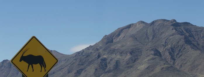
Oryx, an African antelope, have been introduced in the area and roam about. I have rarely seen them but their tracks are often abundant. Because of the Oryx and other features the Park is a great place to take “sign photos”. (The signs are not limited to warnings about the natural history of the area. Some warn of human activities - like tanks.
Lower Gila Box
The Lower Box of the Gila River is located in southwestern New Mexico. In southern New Mexico a “box” refers to a narrow canyon with shear sides, not a “box canyon” which is enclosed on three sides. North of Lordsburg, NM the Gila River runs through a very narrow canyon. After traveling across the flats for quite some time you find yourself on the edge of a canyon which is only visible when you are almost to the edge. In the bottom of the canyon, the Gila (a Spanish word, so it is pronounced Hila) River flows. The remainder of the canyon floor is covered by a Cottonwood forest.
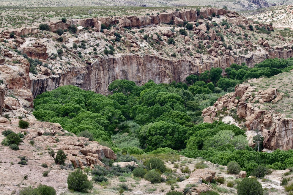
Lower Box of the Gila River, New Mexico
Black Mountain
Iddingsite is found at Black Mountain, which is 10.5 miles northwest (300°) of Deming. As I searched for location information, I came across an article by Kathryn Putsavagewhich described Black Mountain as a major Mimbres site in the “Black Mountain” period (1130 CE to 1250 CE). Basically the reorganization period of the Mimbres people, when they were leaving the Mimbres valley and resettling elsewhere, including Casas Grandes in Chihuahua, Mexico. According to the article, there were Mimbres settlements at Black Mountain from about 750 CE to 1250 CE. Like so many sites of the early people it has been heavily vandalized, including grading by local ranchers.
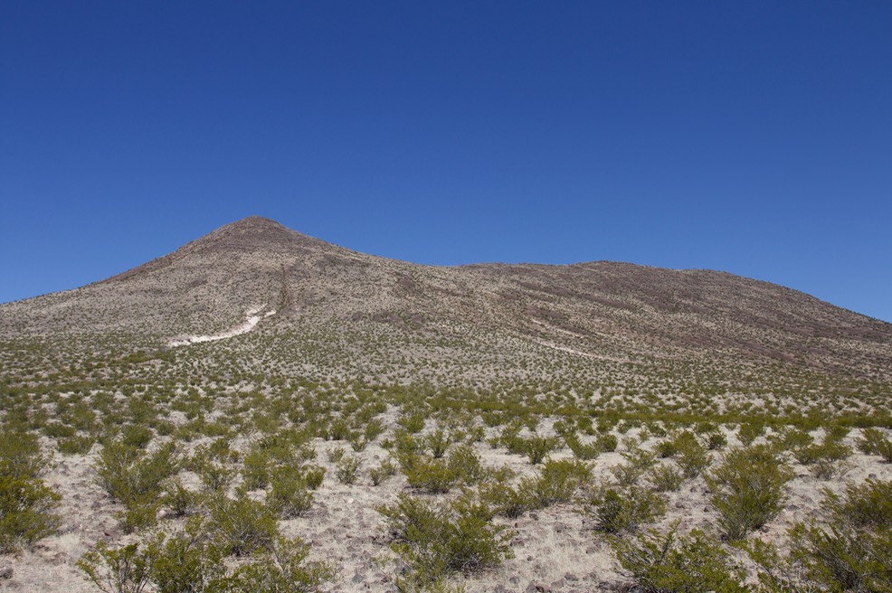
Black Mountain NW of Deming
Access is along the road which borders the mountain on the south. At the se corner of the mountain’s base there is an old New Mexico National Guard rifle range. The mountain is volcanic in origin and basalt rocks cover the slope making for slow progress if you are exploring the area. The white “scar” at the lower left of the mountain is an underlying tuff bed which has become exposed.
The vegetation in this area barely reaches waist high, but it was in this vegetation that we flushed a Long-eared Owl, Asio otus. It flew a short distance and perched on the ground, flushed again and again perched on the ground nearby. We looked for evidence of a nest but found none. There appeared to be only one bird.
There were many Ferocactus wislizeni on the slopes of the hill. This is the Fishhook Barrel Cactus (aka Arizona Barrel Cactus or Southwestern Barrel Cactus). It can grow to six or more feet in height and has a significant number of ribs (15-28), compared to the 13-17 ribs of Ferocactus hamatacanthus which might be possible here. Most of the plants that we saw were rejuvenating from the drought of recent years and appeared to be growing in the midst of dead cactus. The spines of these plants are wonderful - thus the common name for this cactus.
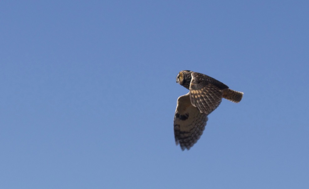
Black Mountain, NW of Deming, Long-eared Owl, Asio otus
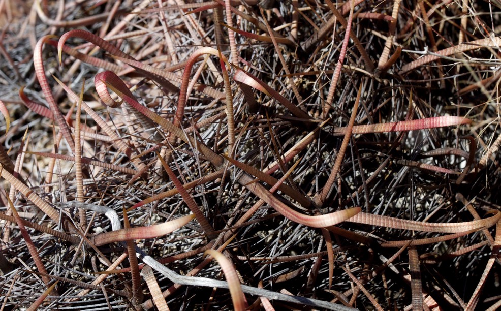
Black Mountain, NW of Deming, Ferrocactus wislizeni
On the slope above the scar, visible in the photograph above, there are a number of plant fossils in the loose tuff. On the day of our visit (March 5, 2015) the temperature was in the mid-forties (F) - well below normal and there was a stiff breeze.
In this area, the Mimbres River crosses US-180 north of Black Mountain and flows west, then south, and finally east, crossing US-180, again, just north of Deming. The loop that it makes borders Black Mountain on three sides and may be a major reason for the Mimbres people locating here. During most of the year the river crossings will be dry.
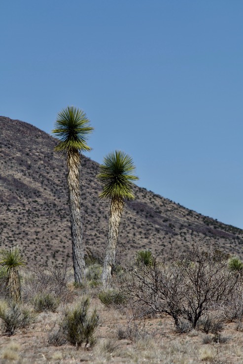
The vegetation in the area is typical Chihuahuan desert scrub. Probably the most unusual plants we saw during our visit were the Desert Willows along the Mimbres drainage and the tall yucca pictured above. We saw few species of birds on our outing; Long-eared Owl, Loggerhead Shrike, Western Meadowlark, Horned Lark, Greater Roadrunner, and Northern Harrier being the most notable.
Potrillo Volcanic Field - Aden Crater
The Potrillo Volcanic Field is southwest of Las Cruces in the southern part of New Mexico. When I have visited the area it has usually been from the west - driving from the Deming area. There are several areas within the Volcanic Field which are of particular interest. If you are interested in road videos, watch: Road to Providence Cone.

Aden Crater Potrillo Volcanic Field 25 miles west of Las Cruces New Mexico, USA
In late August 2014, my brother, Mike, and I took a trip to Aden Crater in the Potrillo Volcanic Field about 30 miles east of Las Cruces, New Mexico, USA. The Potrillo Volcanic Field is located in the Rio Grande Rift which extends from central Colorado, down the Rio Grande River, and into northern Chihuahua.
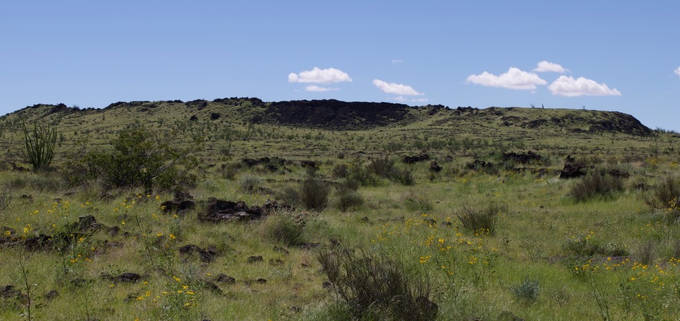
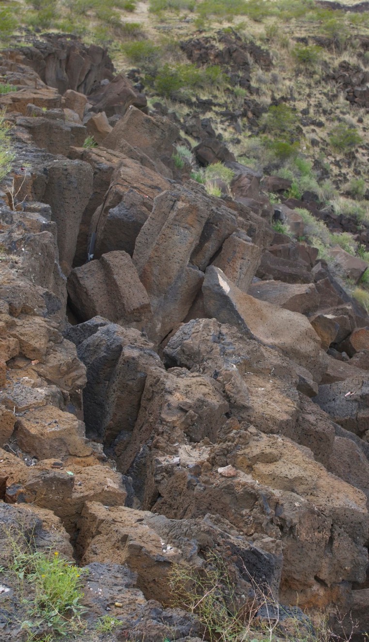
Aden Crater is a small shield volcano which was most recently active about 16,000 years ago. A number of lava tubes are associated with the crater and deep vents are reported at this location. Jerry Hoffer posits that the current geologic feature started as a series of lava flows from one vent, building a shield cone over time. That activity was followed by more explosive eruptions which cast volcanic material outward forming a roughly circular rim around the vent. The formation of the rim was followed by more lava flows which were contained within the rim. The lava tubes, in the lava field within the walls of the crater, are collapsing and the areas along the rim are badly fractured (photo below). As is often the case when the pressure beneath the surface ceases, the lava drained back into underground vents, and eventually the area above the vent collapsed, forming a large pit in the southeast corner of the crater. The west wall of this pit is pictured below the following photo.
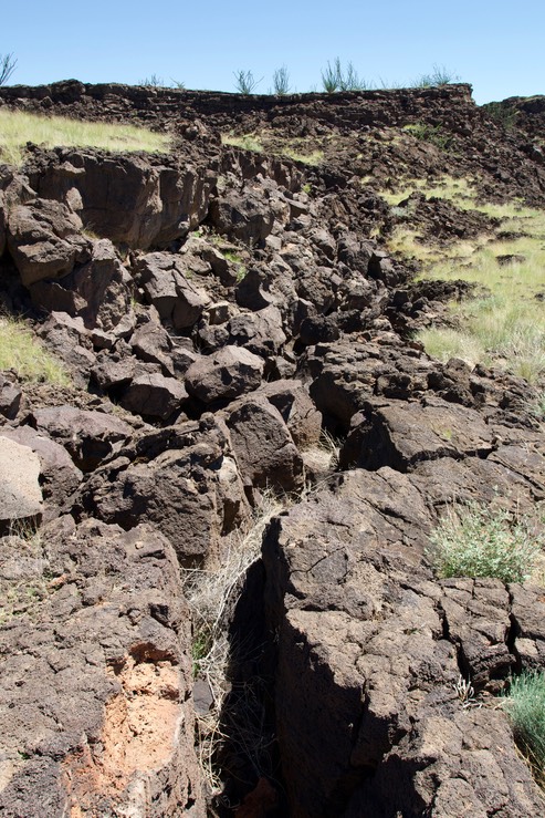
Aden Crater, Potrillo Volcanic Field
25 miles west of Las Cruces
New Mexico
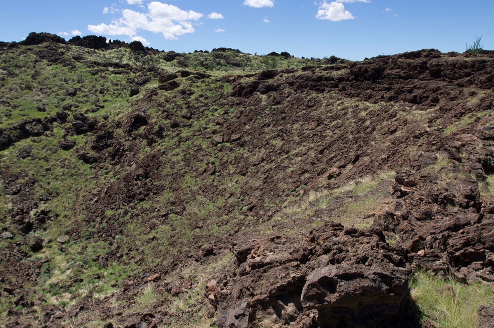
The areas through which we walked to get to the crater, and the crater itself, were covered in grass and wildflowers; in addition to the cholla, yucca, ocotillo, and other plants that we expected. Everything was green, the plants were responding to our recent rains. The photograph below was taken from the top of a small dome in the crater. It is a view of the interior of the crater (looking south). The crater floor is covered with grass and is bounded by the rim of the crater (dark mounds just below the skyline).
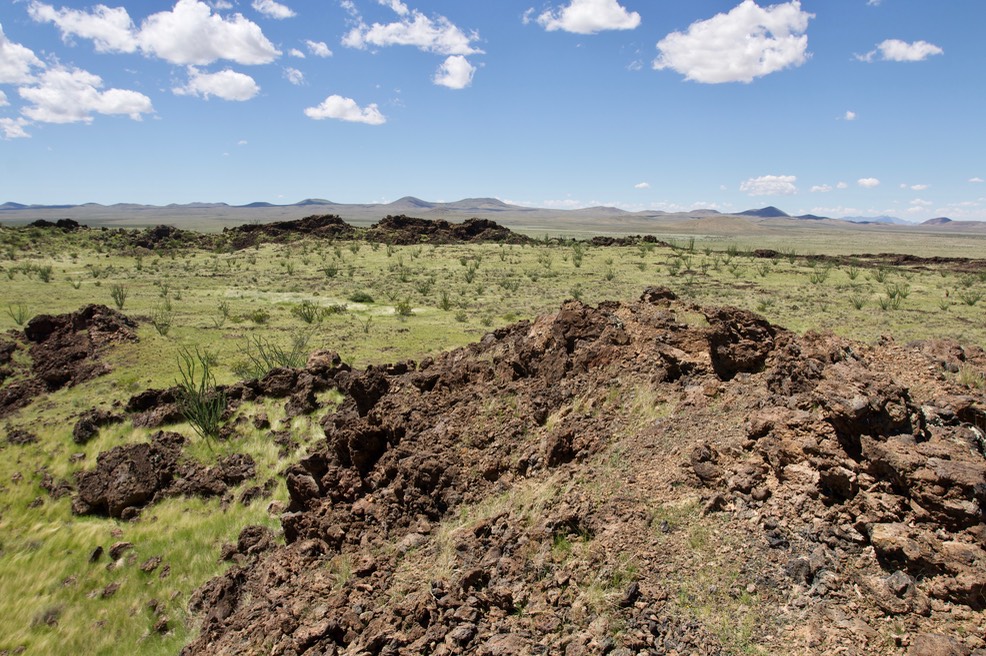
The crater is within a Wilderness Study Area. Vehicles are prohibited within such areas (we noted, however, that some people had illegally driven their vehicles into the crater). We parked at the road and walked south toward an obvious lava cliff on the north wall of the crater (see photo below). The walk was across a lava field which was broken and shattered in places and smooth in others. There were small lava tubes along the way. We entered the crater area just west of the lava cliff mentioned above.
Directions: Take exit 116 on I-10 between Deming and Las Cruces. Travel east for two miles on Frontage Road 1028. This road reaches a dead end. Turn south on a dirt road at this point and travel 7 miles (initially the road heads south but then it intersects a railroad which it follows east on the north side of the railroad right-of-way). At this point, cross the railroad, and continue east on the County Roads which are parallel (and adjacent) to the railroad. At 14.2 miles from the end of the Frontage Road or 7.2 miles from the railroad crossing, turn south on a “one-lane track”. Travel about four miles, the crater is visible for quite some time so where you begin your walk is dependent on parking along the road and your own desires. There are no marked trails. Our walk into the crater was roughly 4,000 feet each way.
Potrillo Volcanic Field - Providence Cone
Providence Cone is best know as a site where there is evidence of Mastodon’s rubbing against the rocks. There are a handful of locales like this in the United States. Providence Cone is to the left in the photograph below, some of the Mastodon Rubbing Rocks are in the foreground. There are also petroglyphs and grinding holes in the area.
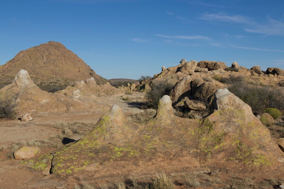
Providence Cone, East of Deming, NM
Potrillo Volcanic Field - Kilbourne and Hunt’s Hole
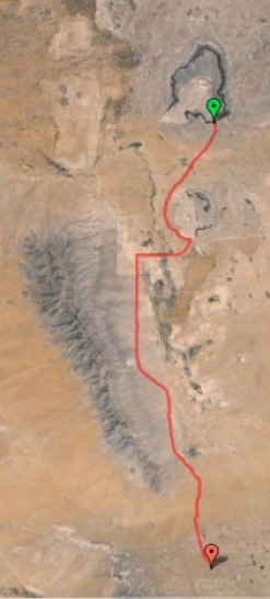 On Saturday (September 6, 2014), my brother, Mike, and I returned to the Potrillo volcanic field south of Interstate-10 between Las Cruces and Deming, New Mexico. Our point of entry for this trip was New Mexico State Road 9. In the map to the right, the US-Mexico border is at the bottom of the image, the starting point is at the red marker (NM-9). From NM-9 we traveled north on County Road-008 (also signed as CR-08 and CR-008). Roughly 3/4 of the way in we took a sharp turn to the right (east) on CR-14 (or CR-014). After a short distance we turned north again and stopped at Hunt’s Hole. After our stop we traveled around the western rim of Hunt’s Hole on A-013. At the “intersection” of A-013 and A-011 it is possible to travel northwest a bit to Kilbourne Hole (the end of this trip indicated by the green marker). The small mountain range to the west of the route are the East Potrillo Mountains which are an example of “rift-flank uplift” along the western edge of the Rio Grande Rift. We were unable to leave the area via A-013 (a public county road) because it was blocked by a locked gate placed by “Joe’s Ranch” owned by Joe Delk, creating a substantial hardship for travelers and potentially a dangerous public safety issue. The roads are dirt and, because of recent rains, mud was very deep in places.
We also visited Phillip’s Hole, which is east of Hunt’s Hole. Phillip’s Hole and the Potrillo Maar (located roughly at the intersection of NM-9 and CR-008) are larger and have less defined features. Often they are not depicted on maps.
These three “Holes” are maar volcanic craters. A maar volcano is created by a steam explosion. Magma super heats water in the ground which is contained in some manner, in this case by a lava flow. At some point the pressure is so intense that the steam explodes upwards. Typically this does not create a volcanic cone but the expelled material and the void left by the steam build up causes the surface to collapse creating a “hole”. In the case of Kilbourne Hole, roughly 500 million cubic yards of material were ejected by the explosion. The age of these maar volcanos is thought to be between 24,000 and 80,000 BP.
All three holes are roughly circular in shape. Kilbourne Hole is about a mile wide (E-W) and two miles long (S-N) and roughly 300’ deep.
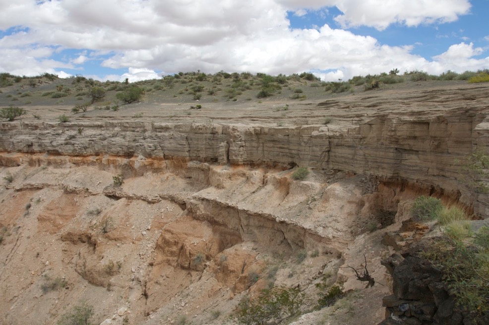
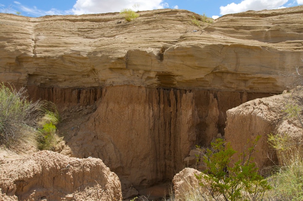
Basalt and pre-sandstone (composed of volcanic ash) cliffs make up the boundaries of Kilbourne and Hunt’s Holes. The photo below shows the cross-bedded volcanic surge material (“sandstone” cap) which covers the Camp Rice Formation (reddish material deposited by a south flowing river which emptied into a playa near El Paso) along the southeast rim of Kilbourne Hole.
Basalt cliffs form the rim of most of Kilbourne Hole. This layer of basalt is what remains of the cap which contained the super heated steam prior to the explosion (photo right).
The cross-bedded volcanic surge material at Hunt’s Hole is similar to the strata at Kilbourne Hole. The unconformity between the volcanic surge material and the Camp Rice Formation is dramatically displayed in places (photo below).
Both Kilbourne Hole and Hunt’s Hole are situated along the Fitzgerald Fault. The Robledo Fault runs along the east side of the East Potrillo Mountains.
Potrillo Volcanic Field - Guzman Volcano
Guzman Lookout Mountain is located a couple miles north of the U.S. - Mexico border on the western edge of Dona Ana County. The mountain is a 519 foot high cinder cone, reaching an elevation of 4,619 feet. Cinder cones are the most common geologic feature in the West Potrillo Mountains. As you can see in the photographs in the photo gallery, the southeastern portion of the mountain has been quarried for scoria. Scoria, is a volcanic rock which is porous like pumice but slightly heavier, it does not float. It has a high strength to weight ratio and is, therefore, used in many construction applications. It is also used in landscaping. The deposit of scoria at Guzman Lookout Mountain consists of well sorted cinder and is about 350 feet thick.
The rock mined here was transported by truck south on County Road A002 to the town of Malpais, which was a water stop on the El Paso &
Southwestern Railroad. It was also the point from which the rock was transported to other parts of the rail line where it was used as ballast for the bed of the railroad. All that remains of Malpais are a few foundations and assorted debris.
This section of railroad line was completed in November of 1902 and abandoned on December 20, 1961. When the railroad operated, trains passing through Malpais at 3:30 p.m. would arrive in El Paso at 5:10 p.m. (West bound: leave El Paso at 8:30 a.m. and pass through Malpais at 10:01 a.m.), taking one hour and forty minutes to cover the 49.1 miles between the two points. Sleeping cars were available on some of the trains running between El Paso and Douglas, Arizona.
The Human Culture of Southern New Mexico
Ojo Caliente is a video about this hot spring which is the point of origin
for the Warm Springs Band of the Chiricahua Apache.
The Ancient Peoples of the World Website, which I maintain, has a large collection of material from New Mexico.
If you are interested in road videos, the Roads of the Western United States video portfolio includes three road videos from this part of New Mexico: one from the Boothill (Cloverdale), one from east of Deming (Providence Cone), and one up a narrow winding road to the old mining town of Mogollon. I also maintain the Roads of the Black Range video Portfolio of the paved and unpaved roads of that range in southwestern New Mexico.
The Black Range, another of my sites, has an extensive amount of material on the human cultural history of this area of New Mexico.
War Eagles Air Museum, Santa Teresa
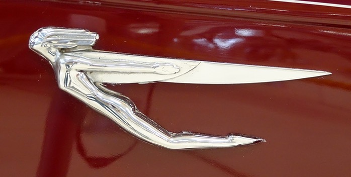
I have visited this museum on several occasions and maintain two photo galleries from it on the Air and Ground website which I maintain. One gallery is devoted to surface vehicles because like many aircraft museums it also has a collection of older cars and other vehicles. A detail from a 1935 Auburn, which I photographed at the museum, is shown at the right. Included in the collection is a 1972 Honda Coupe. When I worked in Washington, DC, in the late '70’s, I carpooled in one of these cars, an hour each way, every four days. Four of us carpooled together so it was a tight fit -- we dreaded the Honda days and were happier on the days when we drove - in a Volkswagen Rabbit.

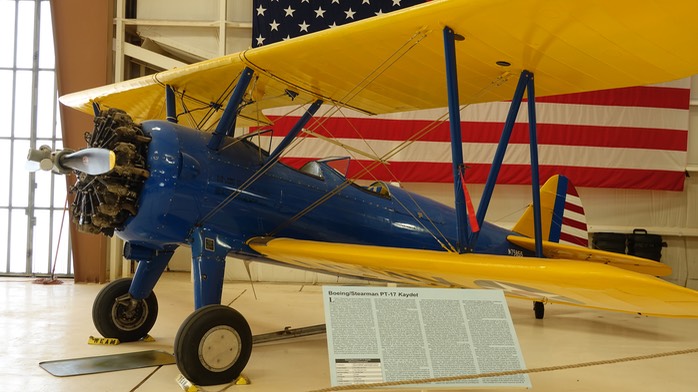
The second photo gallery covers the collection of aircraft at the museum. Like many other air museums, the collection is heavily slanted to military aircraft of the Second World War. More than a decade ago, my daughter (Bethanne) and I flew up the Columbia Gorge (between the states of Washington and Oregon in the United States) in a plane just like this open cockpit Stearman PT-17 which was also on display at the museum. Looking out at the cliffs and waterfalls, which we had often seen from the ground, from a thousand feet in the air - through scratched goggles with heads protected by leather helmets - provided a vantage of our rambles which is mapped into the synapses of my brain.
Salinas Pueblo Missions National Monument
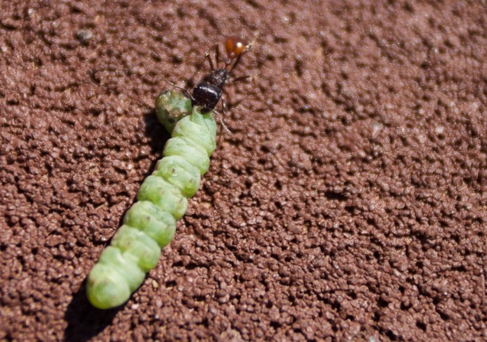
The picture of an ant and caterpillar (right) comes from a trip to the Gran Quivira ruins, in central New Mexico. As we walked along the trail to the ruins I found this small ant pulling a caterpillar across the trail. The immense strength and tenacity of ants is something that Mark Moffett often comments about in his books (see “Adventures With Ants”). E. O. Wilson’s studies of ants have been significant factors in my thoughts on the nature of “intelligence”. At the moment of this photograph the experiences of these two humans and the experiences of this lone ant came together in my mind.
In October 2012 we traveled north and east to visit two of the sites at Salinas Pueblo Missions National Monument. Our first stop was the ruins at Abo, (photo below) west of Mountainair, New Mexico. The last time we were there it was winter, it was cold, there was a bit of snow around and the wind blew strongly. It was intriguing but not terribly enjoyable. This time it was a pleasant fall day with a light breeze, just as intriguing but much more enjoyable.
We have visited the various sites of the Salinas Pueblo Missions National Monument on several ocassions. A photo gallery of these visits is located on my Ancient Peoples of the World website. Visiting these sites in different seasons has had to major benefits: 1) the photographic variety created by the seasons is singificant - a monsoonal thunderstorm is strikingly different from several inches of snow, image wise; and 2) that difference in image is easily transfigured into an understanding of how life changed through the year for the inhabitants of these places.
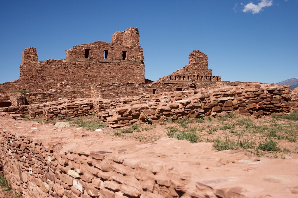
Abo Salinas Pueblo Missions National Monument, New Mexico
On one of these outings, we traveled southeast of Mountainair to visit the ruins at Gran Quivira (photo below). We arrived in time to watch a thunderstorm roll in from the northwest. When lightning began to fork downward to the ground we decided to stop by the small museum (all of the sites have excellent, although small, museums). As we left the ruins we encountered a large family group heading into the ruins and a snippet of conversation, a mother telling her son that there was about as much chance of being hit by lightning as winning the lottery and since they never won the lottery everything would be just fine. (Darwin award recipients often lack an understanding of probability. The likelihood that you might be struck by lightning in the United States over the course of a year may be similiar to the likelihood of wining a national lottery. The likelihood that you will be struck while in the middle of a violent thunderstorm when you are on the highest point around - a point known for frequent cloud to ground lightning strikes - is somewhat higher.) A few moments latter hail and rain began to pound down and since there is no cover in the ruins I am sure the family's visit ended in a drenching. But thankfully no Darwin award on this occasion.
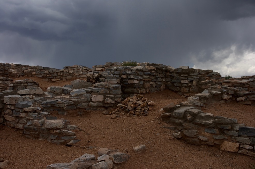
Gran Quivira Ruins Salinas Pueblo Missions National Monument, New Mexico

Las Cruces
Las Cruces is the major metropolitan area in southern New Mexico. It and the associated town of Mesila is steeped in a lot of history.
Some of that history is relatively recent, like its association with the White Sands Missile Range. That close association was recognized by NASA when the Space Shuttle Endeavor was flown to its “resting place” in a museum in Los Angeles. In 2012, I was able to video the fly-over of NASA's 747 mother plane for the Space Shuttles. Photographs from the White Sands Missile Range museum are included in the galleries of the Air and Ground website I maintain.
Gila Cliff Dwellings National Monument
The Cliff Dwellings are just 80 miles from Hillsboro but it is a drive on a slow and curvy road. Google Maps says the drive takes two and a quarter hours - our experience, because we take short stops along the way, is that it is a three hour drive. In any case, 4.5 to 6 hours of travel time is a chunk out of any day. Because of that we have not gone to the Gila as often as we should, it is a strikingly beautiful place.
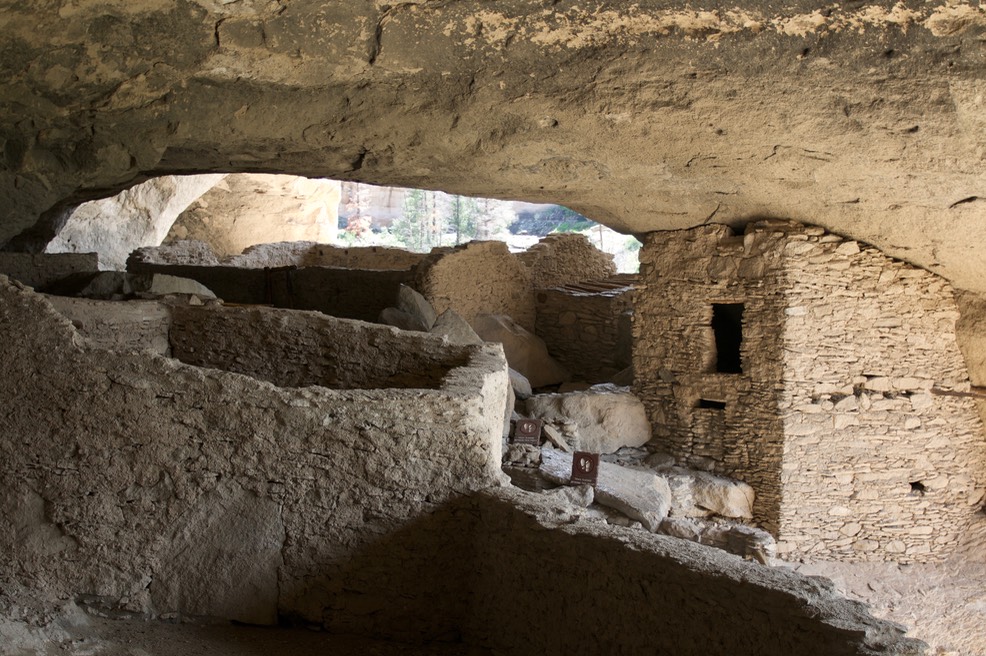
Gila Cliff Dwellings National Monument, New Mexico
The individual sites at the Monument include Archaic (era) rock shelters, Pit Houses, Classic Pueblo structures, and Apache remains - everything from semi-permanent shelters and the classic cliff dwellings, which the Monument is named after, through to decline and the entry of semi-nomadic populations (Apache). It is the only unit in the park system which contains Mogollon sites. The Mogollon were a major cultural center in the southwestern United States, the Mimbres (see my Anicent Peoples of the World website) are generally considered to be Mogollon.
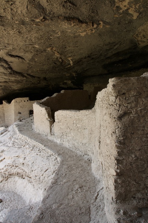
Gila Cliff Dwellings National Monument, New Mexico
"The" cliff dwellings are at about 6,000 feet in elevation and are reached by a short trail. This area gets more rain than we do in Hillsboro. The 18+ inches of precipitation (rain and snow converted to rain amounts) which falls in the Monument every year comes mostly during the monsoons and the Gila River swells at that time. During monsoon we choose not to take some of the trails along the gorges because the water is a bit high (mid-thigh level) and runs muddy. We prefer to hike the gorges, which involves lots of fording the river, when the levels are lower and the water is sparkling clear -- generally early summer. It can be quite cold here in the winter, with temperatures below 0 degrees Fahrenheit at night. One of the things I do when I visit the ruins is to imagine them when it is terribly cold outside -- or very hot -- in both cases, I think of the alcove and the ruins as a snug and friendly place and hope that its inhabitants found them to be the same.
"Gila Cliff Dwellings - An Administrative History" focuses on the administrative history of the Monument but does have a fair amount of information about the earlier inhabitants (especially the Apache) and the geology of the area.
Given the remote location of this site a person might be inclined to believe that they lived in isolation. That is, however, not the case. Trade goods found at the site include macaw feathers, seeds from Mesoamerica, fabrics and other goods from the Sea of Cortez, etc.
“The Tower” at the main cliff dwelling site is shown on the right in the photo below.
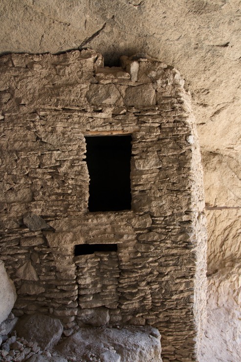
There was a lot of trade going on - but to put that into context. What we now think of as a major site was in fact a relatively small settlement. When it was built, in about 1275 of the Common Era, it housed from 10 to 15 families in its 46 rooms. The trade of various goods was widespread during this era, reaching small settlements in remote regions of the Gila wilderness.
This is a Mogollon site. The Mogollon are first identifiable as a discreet culture from about 200 CE and lived in pit houses until about 1000 CE. They then built pueblo type structures above ground, in some cases free standing and in other cases they were built into cliff alcoves. In the case of this site, the location was not dictated by the cliff alcoves alone. Today we use the term passive solar to describe a major benefit of its aspect. In summer the dwellings are shaded and during the winter they are warmed by direct sunlight.
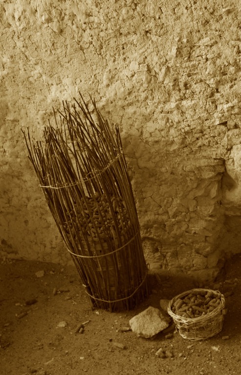
Corn cob display at main cliff dwelling site. Gila Cliff Dwellings National Monument, New Mexico
It is generally assumed that Henry B. Ailman was the first European to describe the dwellings in writing, this in 1878. At that time he wrote:
"Following the west or larger [creek] up two or three miles, we came upon a specimen of an old Cliff Dweller’s village situated, as was their custom, in a crevice where there was good protection afforded by a wide, overhead ledge of projecting rock. In this case, from floor to roof was about eight or nine feet. The walls were of small, flat stones laid in common mud, with no door or window frames. The walls lacked twenty inches connecting with the roof, to give the smoke a chance to escape. They had fireplaces in the center of the apartments.
In searching for relics, the only thing we could find was corncobs, very small, four to five inches long, and only in thickness like your largest finger. A fair sample of these I took with me. This dwelling was about two hundred feet up a steep hill from the creek. We concluded that they selected such sites for protection. Needless to say, Miss Virginia [soon to be his wife] got the corncobs…."
Six years later, in 1874, Adolph Bandelier (after whom Bandelier National Monument is named) visited the site.
At one time there were a substantial number of corn cobs at the site, which are dated to the time of Mogollon occupation, but as noted they soon started to walk away. Until fairly recently it was possible to come close to some of the remaining cobs but many walked away with tourists and now tourists are kept away and the few remaining cobs are displayed in one of the rooms at the dwelling site (see photo above).
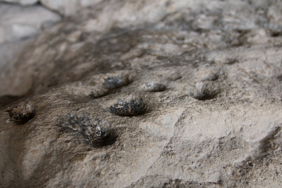
It is posited that these holes were used to grind pigments for the
(limited number of ) petroglyphs at the site.
In addition to the (apparently) successful cultivation of corn the local (prehistoric) population raised three varieties of beans, four varieties of squash, bottle gourds, and cotton. We know that Apaches were harvesting agave and grinding it into a mash to eat, one of several wild crops which filled out their diet and there is no reason to believe that the Mogollon did not supplement their domestic crops in the same way.
Specimens of Phaseolus maculates (formerly P. metcalfi), from the cliff dwellings site, were dated to 1400-1600 in 1990. This dating was performed by Dr. A. J. T. Jull for Kenneth Anderson (US Park Service). The Tarahumara of Chihuahua still use the roots of this plants medicinally and to make glue. This is but one of many examples of how non-domesticated crops were used by the Mogollon.
Archeological Survey: Gila Cliff Dwellings National Monument by James Bradford includes an exhaustive listing of archaeological sites in the monument, including site maps and descriptions. For instance, there is a two room habitation found just north of the Lower Scorpion Campground.
Three Rivers Petroglyph Site
The Three Rivers Petroglyph site is one of the premier rock art sites in southern New Mexico. It is on an exposed hill, so it can be very cold and windy, very hot and windy, or even nice. Photos of the petroglyphs from this site are included in the Ancient Peoples of the World website galleries.
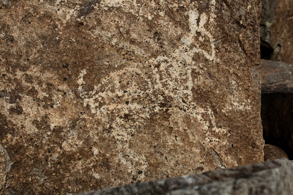
Three Rivers Petroglyph Site, New Mexico
Deming
Deming is the home of the Deming Luna Mimbres Museum which has an excellent collection of Mimbres pottery. (Link will take you to The Ancient Peoples of the World website.). To the east of town are the Florida Mountains and Spring Canyon State Park.
Columbus
South of Deming, on the international border is the small town of Columbus. As well as being the gateway to Palomas, Mexico, this town hosts two museums. The small Railroad Museum is full of artifacts. The Pancho Villa State Park museum celebrates one of the wars between the United States and Mexico. In addition to photographs at the last link, the Air and Ground website has photographs of some of the collection at the state park.